Harita - Çhorotsku (Chkhorotsqu)

Çhorotsku (Chkhorotsqu)
Çhorotsku, Gürcistan'ın Samegrelo-Zemo Svaneti bölgesinde bulunan bir kasaba ve belediyedir. Yüzölçümü 619.4 km² olan belediyenin nüfusu 2014 yılı itibarı ile 22,309'dur. Çhorotsku, Megrelcede "dokuz su kaynağı" anlamına gelmektedir.

 
Harita - Çhorotsku (Chkhorotsqu)
Harita
Google Earth - Harita - Çhorotsku
Google Earth
Microsoft Bing - Harita - Çhorotsku
Microsoft Bing
OpenStreetMap - Harita - Çhorotsku
OpenStreetMap
Harita - Çhorotsku - Esri.WorldImagery
Esri.WorldImagery
Harita - Çhorotsku - Esri.WorldStreetMap
Esri.WorldStreetMap
Harita - Çhorotsku - OpenStreetMap.Mapnik
OpenStreetMap.Mapnik
Harita - Çhorotsku - OpenStreetMap.HOT
OpenStreetMap.HOT
Harita - Çhorotsku - OpenTopoMap
OpenTopoMap
Harita - Çhorotsku - CartoDB.Positron
CartoDB.Positron
Harita - Çhorotsku - CartoDB.Voyager
CartoDB.Voyager
Harita - Çhorotsku - OpenMapSurfer.Roads
OpenMapSurfer.Roads
Harita - Çhorotsku - Esri.WorldTopoMap
Esri.WorldTopoMap
Harita - Çhorotsku - Stamen.TonerLite
Stamen.TonerLite
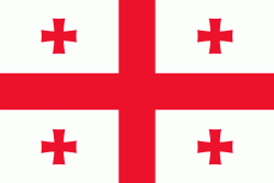
Ülke - Gürcistan
Döviz / Language  
ISO Döviz Sembol Significant Figures
GEL Gürcü larisi (Georgian lari) ₾ 2
ISO Language
AZ Azerice (Azerbaijani language)
HY Ermenice (Armenian language)
KA Gürcüce (Georgian language)
Mahalle - Ülke  
  •  Azerbaycan 
  •  Ermenistan 
  •  Türkiye 
  •  Rusya